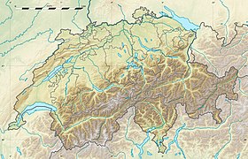
Arrondissement administratif de Berne-Mittelland

Multi tool use

Pour les articles homonymes, voir Berne (homonymie).
L'arrondissement administratif de Berne-Mittelland, appelé Verwaltungskreis Bern-Mittelland en allemand, est un des 10 arrondissements administratifs du canton de Berne en Suisse.
Arrondissement germanophone, il a été créé le 1er janvier 2010 en remplacement des anciens districts de Schwarzenburg, Seftigen, Konolfingen, Fraubrunnen, de Berne et de Laupen, ainsi qu'une commune du district d'Aarberg.
La commune d'Ostermundigen est le chef-lieu de l'arrondissement, qui a une population de 412 838 habitants au 31 décembre 2017 pour une superficie de 943,5 km2. En 2019, l'arrondissement compte 79 communes.
Liste des communes |
Les communes de l'arrondissement administratif
Nom
|
N° OFS[3]
|
Population (décembre 2017)[2]
|
Allmendingen bei Bern
|
630
|
+000579, |
Arni
|
602
|
+000935, |
Bäriswil
|
403
|
+001 065, |
Belp
|
861
|
+011 439, |
Berne
|
351
|
+133 798, |
Biglen
|
603
|
+001 814, |
Bolligen
|
352
|
+006 260, |
Bowil
|
605
|
+001 360, |
Bremgarten bei Bern
|
353
|
+004 420, |
Brenzikofen
|
606
|
+000488, |
Clavaleyres
|
661
|
+0 00046, |
Deisswil bei Münchenbuchsee
|
535
|
+0 00074, |
Diemerswil
|
536
|
+000202, |
Ferenbalm
|
662
|
+001 241, |
Fraubrunnen
|
538
|
+005 037, |
Frauenkappelen
|
663
|
+001 235, |
Freimettigen
|
607
|
+000473, |
Gerzensee
|
866
|
+001 194, |
Grosshöchstetten
|
608
|
+004 185, |
Guggisberg
|
852
|
+001 539, |
Gurbrü
|
665
|
+000246, |
Häutligen
|
609
|
+000253, |
Herbligen
|
610
|
+000600, |
Iffwil
|
541
|
+000444, |
Ittigen
|
362
|
+011 335, |
Jaberg
|
868
|
+000269, |
Jegenstorf
|
540
|
+005 697, |
Kaufdorf
|
869
|
+001 085, |
Kehrsatz
|
870
|
+004 263, |
Kiesen
|
611
|
+000989, |
Kirchdorf
|
872
|
+001 841, |
Kirchenthurnen
|
873
|
+000273, |
Kirchlindach
|
354
|
+003 004, |
Köniz
|
355
|
+041 507, |
Konolfingen
|
612
|
+005 292, |
Kriechenwil
|
666
|
+000420, |
Landiswil
|
613
|
+000628, |
Laupen
|
667
|
+003 093, |
Linden
|
614
|
+001 281, |
Lohnstorf
|
874
|
+000225, |
Mattstetten
|
543
|
+000573, |
Meikirch
|
307
|
+002 499, |
Mirchel
|
615
|
+000630, |
Moosseedorf
|
544
|
+004 114, |
Mühleberg
|
668
|
+002 974, |
Mühlethurnen
|
876
|
+001 378, |
Münchenbuchsee
|
546
|
+010 079, |
Münsingen
|
616
|
+012 533, |
Muri bei Bern
|
356
|
+013 058, |
Neuenegg
|
670
|
+005 543, |
Niederhünigen
|
617
|
+000614, |
Niedermuhlern
|
877
|
+000499, |
Oberbalm
|
357
|
+000869, |
Oberdiessbach
|
619
|
+003 523, |
Oberhünigen
|
629
|
+000308, |
Oberthal
|
620
|
+000731, |
Oppligen
|
622
|
+000644, |
Ostermundigen
|
363
|
+017 546, |
Riggisberg
|
879
|
+002 491, |
Rubigen
|
623
|
+002 924, |
Rüeggisberg
|
880
|
+001 789, |
Rümligen
|
881
|
+000440, |
Rüschegg
|
853
|
+001 630, |
Schwarzenburg
|
855
|
+006 827, |
Stettlen
|
358
|
+003 105, |
Toffen
|
884
|
+002 557, |
Urtenen-Schönbühl
|
551
|
+006 222, |
Vechigen
|
359
|
+005 242, |
Villars-les-Moines (Münchenwiler)
|
669
|
+000514, |
Wald
|
888
|
+001 171, |
Walkringen
|
626
|
+001 782, |
Wichtrach
|
632
|
+004 318, |
Wiggiswil
|
553
|
+000102, |
Wileroltigen
|
671
|
+000357, |
Wohlen bei Bern
|
360
|
+009 215, |
Worb
|
627
|
+011 394, |
Zäziwil
|
628
|
+001 628, |
Zollikofen
|
361
|
+010 314, |
Zuzwil
|
557
|
+000572, |
Total
|
+412 838,
|
Notes et références |
↑ « Arrondissement de Berne-Mittelland - Contact », sur https://www.jgk.be.ch (consulté le 11 février 2018)
↑ a et b« Population résidente permanente et non permanente selon les niveaux géographiques institutionnels, le sexe, l'état civil et le lieu de naissance », sur Office fédéral de la Statistique.
↑ [xls] « Liste officielle des communes de la Suisse - 01.01.2016 », sur Office fédéral de la statistique (consulté le 17 février 2016)
Communes de l’arrondissement administratif de Berne-Mittelland
|
.mw-parser-output .sep-liste{font-weight:bold}
Allmendingen · Ani · Bäriswil · Belp · Berne · Biglen · Bolligen · Bowil · Bremgarten · Brenzikofen · Clavaleyres · Deisswil bei Münchenbuchsee · Diemerswil · Ferenbalm · Fraubrunnen · Frauenkappelen · Freimettigen · Gerzensee · Grosshöchstetten · Guggisberg · Gurbrü · Häutligen · Herbligen · Iffwil · Ittigen · Jaberg · Jegenstorf · Kaufdorf · Kehrsatz · Kiesen · Kirchdorf · Kirchenthurnen · Kirchlindach · Köniz · Konolfingen · Kriechenwil · Landiswil · Laupen · Linden · Lohnstorf · Mattstetten · Meikirch · Mirchel · Moosseedorf · Mühleberg · Mühlethurnen · Münchenbuchsee · Münsingen · Muri bei Bern · Neuenegg · Niederhünigen · Niedermuhlern · Oberbalm · Oberdiessbach · Oberhünigen · Oberthal · Oppligen · Ostermundigen · Riggisberg · Rubigen · Rüeggisberg · Rümligen · Rüschegg · Schwarzenburg · Stettlen · Toffen · Urtenen-Schönbühl · Vechigen · Villars-les-Moines · Wald · Walkringen · Wichtrach · Wiggiswil · Wileroltigen · Wohlen bei Bern · Worb · Zäziwil · Zollikofen · Zuzwil
|
 |
Canton de Berne · Arrondissements administratifs du canton de Berne · Communes du canton de Berne
|
Découpage administratif du canton de Berne
|
Arrondissements (depuis 2010) |
Bienne · Berne-Mittelland · Emmental · Frutigen-Bas-Simmental · Haute-Argovie · Haut-Simmental-Gessenay · Interlaken-Oberhasli · Jura bernois · Seeland · Thoune
|
 |
Anciens districts (avant 2010) |
Aarberg · Aarwangen · Berne · Berthoud (Burgdorf) · Bienne · Büren · Cerlier (Erlach) · Courtelary · Fraubrunnen · Frutigen · Gessenay (Saanen) · Interlaken · Konolfingen · Laupen · Moutier · La Neuveville · Nidau · Niedersimmental · Oberhasli · Obersimmental · Schwarzenburg · Seftigen · Signau · Thoune · Trachselwald · Wangen
|
Canton de Berne · Communes du canton de Berne
|
Portail de l’Espace Mittelland
Y7PLu7YQ,GUaY3yFY2Kpj,7c,3IATaplSa7CDmVIFw0D 0QPDdOAW4ey9kzqRc6B shgff4LK X5 Y,Z,Fq
Popular posts from this blog
Pour les articles homonymes, voir Mouloudia (homonymie) et MCA. Le ton de cet article ou de cette section est trop élogieux, voire hagiographique (mars 2018). Modifiez l'article pour adopter un ton neutre ou discutez-en. Le fond de cet article sur le sport est à vérifier (septembre 2018). Améliorez-le ou discutez des points à vérifier. Si vous venez d’apposer le bandeau, merci d’indiquer ici les points à vérifier. .mw-parser-output .entete.football{background-image:url("//upload.wikimedia.org/wikipedia/commons/f/f8/Infobox_Football_pictogram.png")} Mouloudia Club d'Alger Logo du Mouloudia Club d'Alger Généralités Nom complet Mouloudia Club d'Alger Surnoms Le Mouloudia Le Club du Peuple le MCA Les Verts et Rouges Le Club des Martyrs Noms précédents Mouloudia Club Algérois (1921) Mouloudia Club d'Alger (1930) Mouloudia Châabia d'Alger (1970) Mouloudia Pétroliers d'Alger (1977) Mouloudia d'Alge...
0
1
I have an ASUS Zenbook UX433,on which ASUS decided to innovate by embedding a Numpad inside the touchpad (see picture 1). Toggling between classic touchpad mode and numpad (also turns the touchpad LEDs on) can be done through the golden button in the top-right corner of the touchpad. However, on my Manjaro arch Linux config, this behavior does not work by default and I can only use the touchpad, no numpad. Has anyone been able to configure the numpad to work on Linux, or have any idea how this could be achieved? EDIT1: I have had a look at the official Windows drivers for the UX433FA TouchPad, but was not able to make anything of it. I tried installing them on Linux using tools like NDISWrapper, but they do not detect the TouchPad/Numpad hardware, and my understanding of drivers is too limited. ...
Cet article est une ébauche concernant la géographie de la Suisse. Vous pouvez partager vos connaissances en l’améliorant ( comment ? ) selon les recommandations des projets correspondants. Ueberstorf.mw-parser-output .entete.map{background-image:url("//upload.wikimedia.org/wikipedia/commons/7/7a/Picto_infobox_map.png")} Héraldique Administration Pays Suisse Canton Fribourg District Singine Syndic Hans Jörg Liechti NPA 3182 N° OFS 2308 Démographie Population permanente 2 371 hab. (31 décembre 2017) Densité 147 hab./km 2 Géographie Coordonnées 46° 51′ 56″ nord, 7° 18′ 51″ est Altitude 668 m Min. 546 m Max. 814 m Superficie 16,12 km 2 Divers Langue Allemand Localisation Carte de la commune dans sa subdivision administrative. Géolocalisation sur la carte : canton de Fribourg Ueberstorf Géolocalisation sur la carte : Suisse ...